Engineered Systems LtdProgramme and Project Management by Ed Johnston |
Mobile +44 (0)7860 663886 |
Met Home Page
How I normally go about looking at the weather...
Of course no two days are the same, but often analysis starts the same way:
The Synoptic Situation
 See where the air is coming from, fronts and isobar curvature
Charts are available from many sources- this is my preferred site. You should also have a decent idea of the recent past and can see where it is going in the near future so you can see how things are moving- deteriorating or improving...
Satellite View
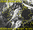 Next, check that the current satellite view matches the
impression built up from synoptic. Are the fronts where they should
be? Cross reference the IR and Visual with IR giving a better view
of high cloud.
Next, check that the current satellite view matches the
impression built up from synoptic. Are the fronts where they should
be? Cross reference the IR and Visual with IR giving a better view
of high cloud.
Sat24 gives an excellent animation, allowing decent resolution and really good ability to visualise where the weather is and where it is going.
Dundee has an excellent array of hi resolution imagery. It requires registration but no costs. Though Sat24 gives a really good view of how things are moving, Dundee can give better resolution for one-off images.
 The full spectrum of images is available too, from long IR
through to short visual. Longer shows higher altitudes...
The full spectrum of images is available too, from long IR
through to short visual. Longer shows higher altitudes...
Use the Water Vapour pics if you are desperate to find a better slot to fly into on a generally bad, damp airmass.
Occasionally I look at Low Earth Orbit pictures. Usually after the day has passed to see what actually happened. They are a thing of beaty, not much use for forecasting.
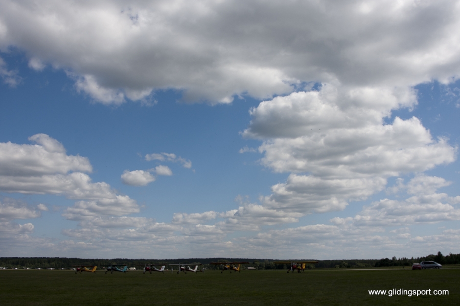
The Actual Ascent
So
having got an idea of the general situation and where the weather is
coming from, go look for best real ascent you can find from UK
Soundings:
So you then work out what is going on. Of course- not much good without some temperatures, but you should have a decent view of top temp and dew point from WeatherOnline:
Get the dew points through the day and maximum temperatures and use this to predict where the ascent suggest things are going...
Some Raw(ish) Data
 So
that should give an idea of the amount of energy in the atmosphere,
cloud base and (the trickies of all) the amounts of cloud. Weather
Online has a couple more really good pages to look at:
So
that should give an idea of the amount of energy in the atmosphere,
cloud base and (the trickies of all) the amounts of cloud. Weather
Online has a couple more really good pages to look at:
The amount of Cirus can be gagued by the relative humidity at 300hpa. 80-90% will give a load of cirus very reliably.
Low cloud base amounts are also good for a guess of convective cloud cover. Be ware though. GOod days and the cloud cover could be zero at low levels, but 8/8 at the higher levels. Look through the relative humidities at mid levels too.
Comparative Forecast Ascents
So far so good, and on good days and bad days, that will probably be enough.
Mostly we fly inbetween days days... Then, working out whether to go one way or another is critical and though the forecast ascents may not be accurate, they will usually show if one area is generally better than another. I use one or more of these:
Cambourne: Far south west tip of Cornwall- compare this with actual soundings
Larkhill: Southern central- compare with actual soundings
Nottingham: Central northern England- compare with actual sounding
Buckingham: centre of southern England
Aston Down: Heart of the Cotswolds
Cambridge: Heart of East Anglia
Hay on Wye: Welsh boarders
Lasham: Because you have to
Welshpool: Central Northern Wales
York: Northern England north of Humber
And Finally: RASP
![]() So
once you have worked out where you think you are going and for what
distance in which conditions, then check what RASP has to say for
itself.
So
once you have worked out where you think you are going and for what
distance in which conditions, then check what RASP has to say for
itself.
Of course a lot of this data is the same as what RASP uses for its soaring model, so in th ideal world, they will be the same... If it doesnt, then start over and try to work out where the fault is coming from.
RASP often over- estimates the amount of mid level could and how much it reduces soaring.
Also if often says it will be blue when there are at least cloud traces if not fully formed cumulus.
Bases are often good unless RASP expects spread out or showers. Then it massively under-estimates what it will be.
However, though it often makes big errors, it can also get things spooily right. I landed out an entire Nationals because I couldn't work out why it said the central UK would be bad. Oops!